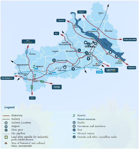
Situated in the central forest-steppe zone of Ukraine, in the middle of the rivers Dnieper and Southern Bug.
It borders on the north with Kyiv region (length 340 km), to the east – with Poltava (212 km), to the south - Kirovograd (388 km) and to the west - Vinnytsia (124 km) regions.
In Cherkasy region, near the village Marianivka of Shpola district, there is the geographical center of Ukraine with coordinates: 49 ° 01 '39' of north longitude, 28 '58 ° 31' of east latitude.
The area of Cherkasy region is 20,9 thousand square kilometers, which is 3,5% of the state’s territory (18th place in Ukraine).
The distances to the major economic centers of Europe are:
 |
 |
 |
 |
 |
| Berlin – 1523 km | Budapest–1234 km | Warsaw– 954 km | Vienna - 1534 km | Prague – 1599 km |
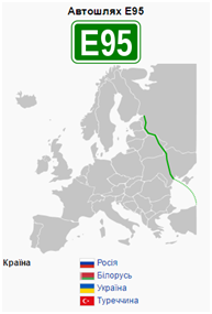
| European highways crossing the region: | |
 |
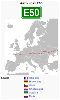 |
| Е95 - St. Petersburg, Gomel, Kyiv, Odessa, Samsun, Merzifon | E50 - Paris, Nuremberg, Prague, Trenčín, Uzhgorod, Kropivnitskiy, Rostov-on-Don |